
Topographic Surveys determine the elevation and location of natural and man-made surface features and existing site conditions including:
- Ground elevations
- Drainage features | Detention facilities
- Concrete and paved areas
- Hills and ravines
- Buildings
- Roadways and walks
- Trees
- Utilities
- Wetlands/Waterways
Topographic surveys can be performed in conjunction with Boundary or ALTA/NSPS Land Title Surveys and can show property lines and recorded easements if required.
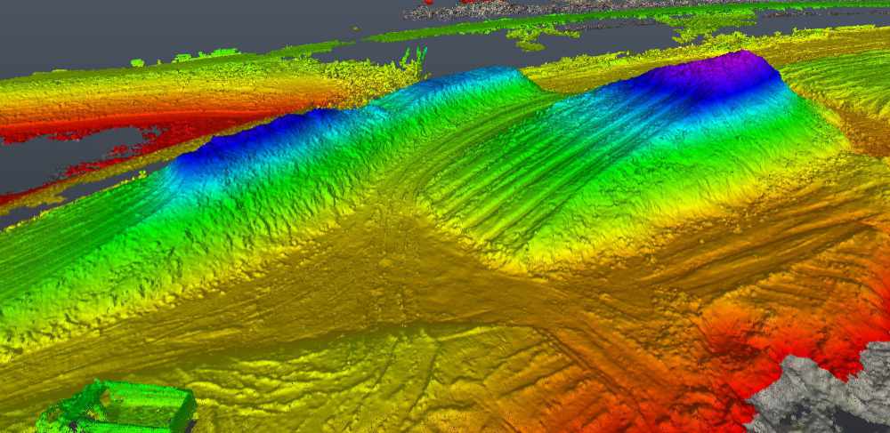
Color Elevation Map
Why Are Topographic Surveys Needed?
Topographic Surveys are necessary to:
- Show the existing overall drainage pattern
- Study areas prone to flooding
- Determine the location of flood plains
- Provide an accurate “existing conditions” survey of elevations and surfaces for site design and roadway plans
- Verify manhole RIM elevations during construction
- Provide final as-built data to verify that the site was built in substantial conformance with proposed plans
- Verify ADA compliance
Our topographic surveys include existing ground elevations and contour lines, the location and elevation of existing utilities, and existing stormwater features, which are critical for the planning and design phases of land development, roadway and infrastructure projects.
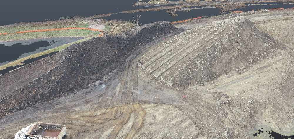
Point Cloud of Stockpile
When Are Topographic Surveys Needed?
Compass’s professional land surveyors can provide a full range of topography and mapping services for various stages of land development, construction and infrastructure projects including:
- As-Built Surveys
- Benchmarks and elevations
- Cross-sections
- Earthwork quantities
- Floodplain mapping
We can provide you with a lump-sum fee or “not to exceed” budget for your project.
To further discuss the land survey service your project needs, contact us at (630) 820-9100 today to speak with a Compass professional.