
To honor National Surveyors Week (March 17-23), we want to highlight a few land surveyors who have impacted our country. Notably, these surveyors also happened to be U.S. Presidents. They played a big role in making our country what it is today.
Past presidents of the United States are often remembered for individual accomplishments, but three of the four presidents featured on Mt. Rushmore, also had an instrumental role in the way of creating America.
Thomas Jefferson
Thomas Jefferson was instrumental in creating the Public Land Survey System (PLSS) for the United States after the Louisiana Purchase. Jefferson proposed the Land Ordinance of 1785 that marked the beginning of the Public Land Survey System. At the time, the U.S. government wanted to distribute land to Revolutionary War soldiers as a reward for their services, and sell land as a way to raise money for the nation. However, before this could happen, the land needed to be surveyed, Jefferson enlisted in the help of Meriweather Lewis and William Clark.
There were 1.5 billion acres surveyed into townships and sections (1 square mile) during the 1800s. During that time the vast open land was sold by the federal government for $1.25 per acre. In 1800, the minimum lot was halved to 320 acres and settlers were allowed to pay in four installments.
George Washington
George Washington was one of the most notable land surveyors in American history, laying the lines for the Western Virginia frontier. In 1749, George Washington was appointed to serve as the Surveyor General for Virginia at the age of 17. The role was essential because surveying the land promoted westward expansion for the growing country.
Abraham Lincoln
Abraham Lincoln signed the law known as The Homestead Act of 1862. By May of that year, 11 states had left the Union, and this piece of legislation would continue to have regional and political overtones. The Homestead Act of 1862 allowed any citizen who did not fight in a war against the United States to purchase 160 acres of land.
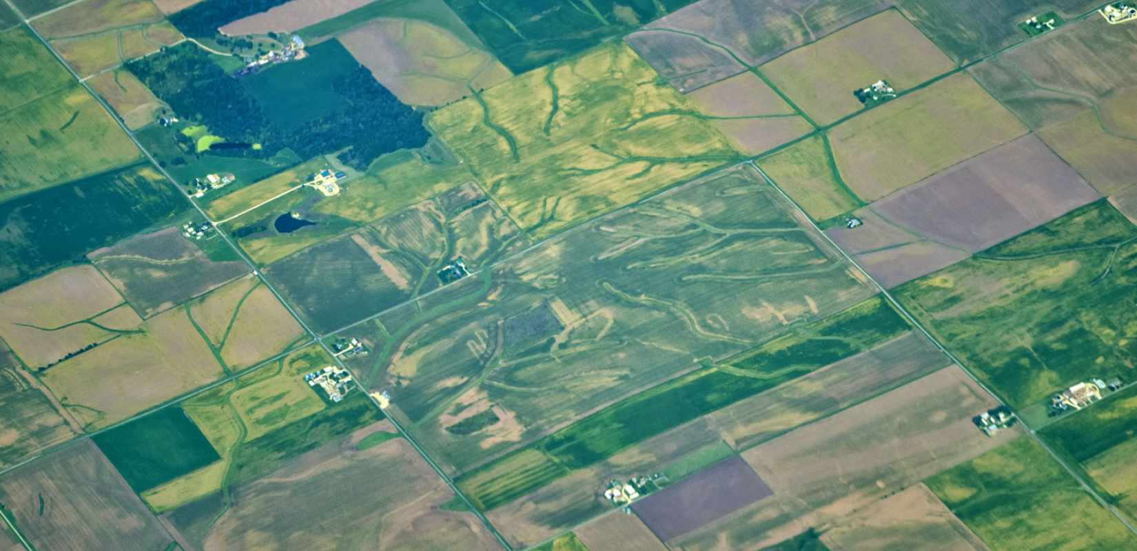
Between 1805 and 1850, government surveyors subdivided Illinois into six-mile squares (called townships), 1-mile squares (called sections) and 160 ac “lots” (called quarter-sections), creating the “checkerboard patterns” seen while flying over Illinois.
Survey Technology at a Glance
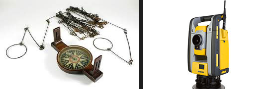
- 1780-1890 – Surveyors used the compass and chain to trace lines.
- 1890-1975 – Over the course of 85 years, technology changed rapidly and surveyors started using steel tape and engineers transit to trace lines.
- 1975-1985 – Surveyors started using Electronic Distance Measuring (EDM) devices to retrace the Public Land Survey System lines, where the original government surveyors placed them.
- 1985-Present – As technology has continued to change, surveyors have had to learn new tools, including total stations and data collectors to help them retrace the PLSS lines.
- 1990-present – Surveyors have continued to retrace PLSS lines, and follow in the footsteps of original government surveyors by using global positioning system(GPS), 3D laser scanning and UAV’s or drones to make measuring become faster and more accurate.
A Tribute to Land Surveying
Although the men carved into Mt. Rushmore were first and foremost great presidents, Washington, Jefferson and Lincoln were also noted surveyors – so it is only right to commemorate them. In March of 1984, Ronald Reagan proclaimed the third full week of March as National Surveyors Week as a way to pay tribute to professional surveyors and their contribution to society.
In his proclamation letter, Reagan stated: “I invite all Americans to look back at the historic contributions of surveying and look ahead to the new technologies which are constantly modernizing this honored and learned profession.”
The United States wouldn’t be where it is today without the work of our past surveyors and leaders who have literally paved the way for how America is today!